The nest is empty –
We must be on the road again!
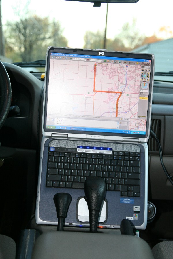
We were about 30 miles down the road before I realized something was missing. We were driving blind as we had left the laptop at home and this was a 3 day weekend. If you have read the article on the GPS below, you saw how large it was and you might ask, “How could you forget or at least not notice the absence of the laptop?” As any good politician would say, “That’s a good question.” and then there would be some long dissertation on some irrelevant situation before moving to the next question. Well, I’m no politician and I say that proudly especially after this election. I was brought up to tell the truth; so to answer your question, ” I’m 60 years old; my hearing isn’t what it used to be so I didn’t notice the missing hum from the blower. My eyesight is not the eagle eye status it was when I first traveled these roads so I just didn’t notice the now visible radio and heat controls. And, well I hate to admit it but I suspect a slight downturn in brain matter replacement. Did I mention I turned 60 this year. Now, what was the question?
I knew we didn’t need the mapping aid for the trip down to SIU because since my daughter’s recent transfer to the school we have made 4 – 5 trips down. We had to check it out before she signed up; we had to go down for her to sign up and we had to take her down with a full load of necessities. It was certainly a full load. She had her car packed as did we. Pat and I moved less to our new apartment in Chicago when we got married. To give you an idea of a time line here, the “old route” 66 signs were referring to the road we were on. Did I mention , I was 60? Next, we had to take down a new refrigerator because the one she rented was “nasty” as she put it. Now you might think this was the end of our short trips to Southern Illinois but you would be wrong because the dorm didn’t work out and a move to an apartment off campus was next on the agenda. Of coarse, that required additional “supplies” like furniture. Now I have lost count but you get the picture.
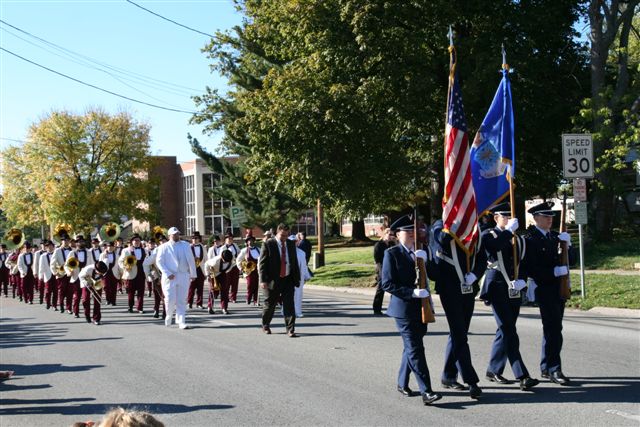
The trip down was rather uneventful and we didn’t miss the GPS. The first night, we stayed in a cabin at Giant City State park. That was nice and I would do that again. We took a few pictures in the park before heading into town for the parade.

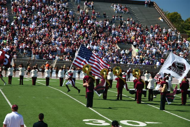
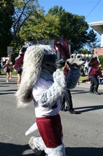
It was a beautiful day and there were some great school bands.
After a picnic in the Alumni tent, we headed into the stands for the game. It was fun to watch the kids and younger alum with all their excitement.

We looked at each other and wondered if we ever acted like that. Some how the back roads of Southern Illinois kept nagging at my brain. We made it until half time and took off.
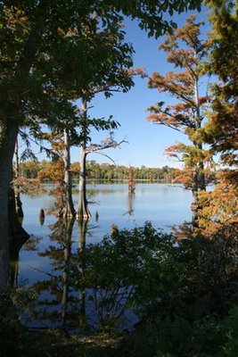
We headed south toward Metropolis and made a stop at Ferne Clyffe State Park South of Goreville on Rt 37.
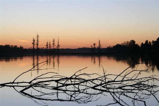
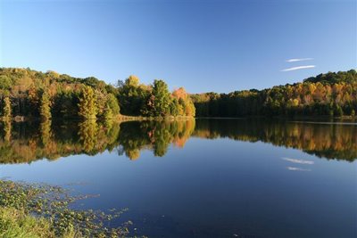 The lake there couldn’t have been more perfect. The reflection of the trees doubled the bright fall colors. It was spectacular. Our next stop was Mermet Lake on route 45 northwest of Metropolis. There we enjoyed the setting sun.
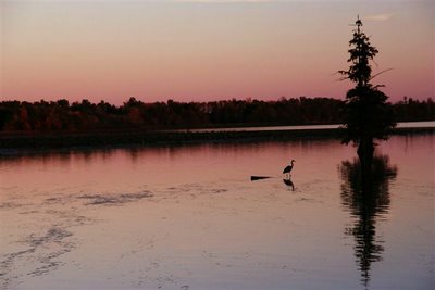 A lone great Blue heron was silhouetted against the reds of the setting sun.

The now dark road into Metropolis was a bit unnerving without the aid of our GPS but we made it to town and eventually found a vacancy at a Best Western. It turned out to be nicer and even less expensive than the Comfort Inn we stayed at during an earlier visit.
AS you might know, Metropolis is the home of Superman and while the downtown Superman attractions are a bit run down, it is still worth a stop for a picture. I pictured my wife standing underneath between his giant legs looking up at his gigantic . . . . . . I’ll leave this to your imagination.
Metropolis is also the home of Fort Massac State Park. We toured that on our last trip. This brings us to a close for the night. Tomorrow we will head along the Ohio river By Way toward Cairo the southernmost point in Illinois.
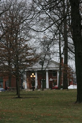
Morning brought with it another beautiful day and after a delicious breakfast at the motel, we headed southwest toward Cairo. The Ohio By-Way road took us along the river with an occasional vista to turn out and look over the valley. We made a stop at Olmstead to see the construction of a new lock and damn and on to Mound City to photograph the county courthouse. Pat wants to compile a book of all the county courthouses in Illinois. I only took one picture of it. That tells the story. It looked like an old school.
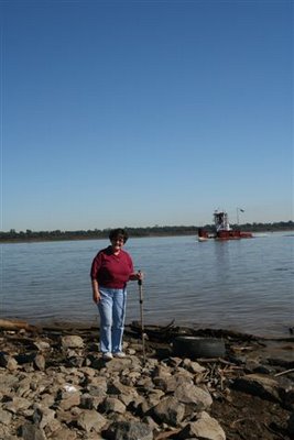 At right, you can see Pat standing on the southernmost tip of Illinois where the Ohio and Mississippi join and head for the gulf. Don’t tell anyone but I picked up a rock from the very end so the state is a little shorter now. Fort Defiance once stood here and the area is now set aside as a park. The park was rather run down but it was worth stopping just to say we had been to the tip!
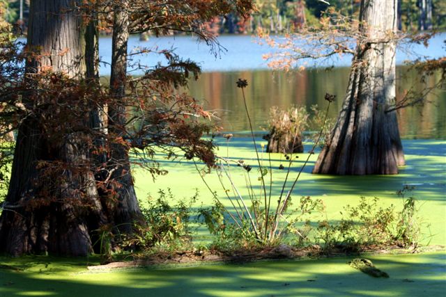
At this location, the only way to stay in Illinois was to head north so now we followed the Mississippi River along the Great River Road to the north and west along Rt. 3 into the cache River reclamation area. We had visited this area early in the summer for a photo workshop and found it awesome. I never knew there was swampland in Illinois. You don’t expect to see cypress trees and green water here. We headed over to horseshoe Lake on the southwestern edge but if this is your first time down here, I recommend going to the Cache River Wetlands Visitors Center on route 37 due east of Belknap. From there you can get information about Heron Pond and other spots along this watershed. This would be east and north of our location at Cairo so we left that for a second visit at a later time. Horseshoe Lake is near the Mississippi, south of Thebes. Below, you can see one of the many beautiful sights. The road to the campground takes you around on the west side of the lake. It is quite a way back but well worth it. We will definitely go back there again.

It is so alive with vegetation, birds and bugs! You will want to carry your trusty insect repellent throughout this area.
 This is a picture from around on the east side and repeated itself every time we saw a clearing.
We continued north to Thebes for the court house shot and it was very modern by comparison to most of the others I have photographed. Next stop on our itinerary was Chester, the home of Popeye. We bypassed Cape Girardeau to save time but in retrospect, we probably should have stopped there as there are many photo ops there. As it turned out, we wasted considerable time going over to Kinkaid Lake which turned out to be a waste of time.
AS we drove down an uneventful Rt 3, I saw a sign for some kind of wildlife ravine. It was around Cora as we crossed the corner of the Shawnee National Forest. It was a gravel road and remember we were without the GPS! We turned off onto Hog Hill Road. This gives you some idea of our surroundings. The road wound around and had several intersections and we were flying blind. I kept thinking we would see another sign. This road, and I use the term loosely, jigged and jagged and eventually made its way to Piney Creek Ravine State Natural area. Well, we made it but all it turned out to be was a small grass lot and a trail head. We were not looking to take a trail although it might have been beautiful so we planned our next itinerary. With the GPS it would have been so easy but with just a state map, we had no idea where we were. Rock Crusher Road went east; and Piney Creek Road went west or we could go back the way we came but I knew we had come quite a way north as I had been watching the car compass. I didn’t know how far east. Our next itinerary was Chester. I guessed it would be approximately due west so I took the Piney Creek Road. It would around, up and down and became more and more primitive. I was beginning to question my judgment. Just then we came around a curve and there on a bridge ahead we saw a truck parked and a backwoods Mom was there with two little boys playing with frogs near the stream. Fortunately it wasn’t the brothers from Deliverance. She looked like an angel to me. We stopped and asked where the hell we were and how to get to Chester. AS it turned out about a mile up this road we would intersect with the Chester blacktop. On my map program that I can now check, it is simply listed as County Farm Road. It wound around and eventually ended in Chester. We made it!
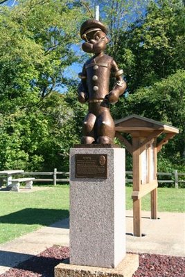
It was obvious Popeye got a lot more attention than Superman did in Metropolis. I took a few pictures for us and then offered to take a few shots for a motorcycle group touring.
By this time we were both adventured out and we hit the road home. No more winding Great River Road. We continued up Rt 3 to 255 and on to Interstate 55 north to Springfield. Home felt really good that night.
There are many more back roads to travel so come back often and join in as we take flight from the empty nest to see the roads less traveled.
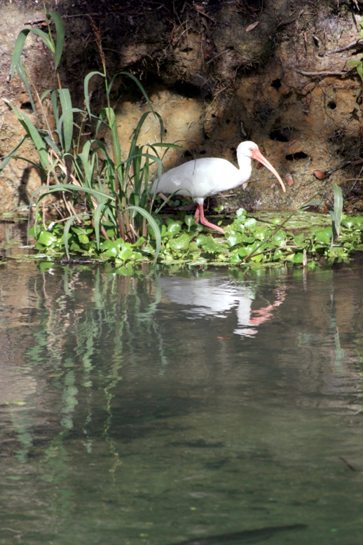
 Our visit to Florida included a stop at Florida’s Blue Spring State Park for a view of the Manatees. Here you can see an adult weighing in at about one ton. That is 2,000 pounds of lovable sea mammal. The clear 72 degree spring water makes viewing from the observation platforms outstanding. In the cool winter months, the manatees move up into the Blue Spring run of the St. John’s River for the natural warmth. As the waters warm, they will move further out into the bay. For that reason, it is best to view them in the morning or later in the afternoon on warmer winter days.
 Here a mother can be seen with her young as they head out into the bay. This area was rich in other natural wildlife and my camera was often drawn to the beautifully majestic shore birds. While the Great Blue Heron is not exclusive to this part of the country even in the winter months, the surrounding moss laden Live Oak trees make a stupendous background as seen below.